About All Tours From Marrakech ToursQuad Biking ToursPrivate ToursOvernight Stay ToursCamel Ride ToursSunset ToursLuxury Tours Directions Hours & Fees
Find Tours 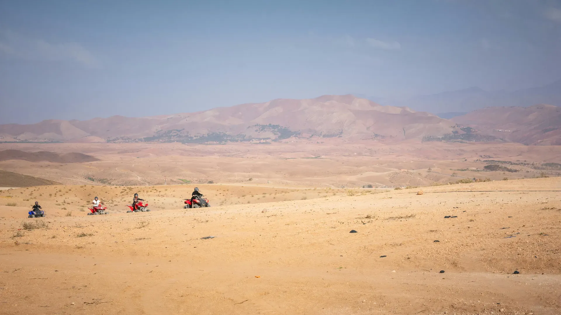
A 400-square-kilometer expanse of rock and clay sits 35 kilometers outside Marrakech, backed by the snow-capped High Atlas Mountains. The Agafay Desert trades the shifting sand dunes of the Sahara for firm, lunar-like plateaus and dry riverbeds.
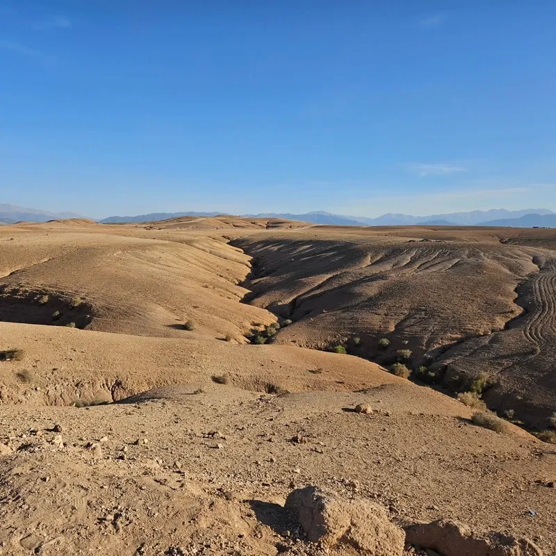
White and ochre hills roll across a 400-square-kilometer basin just 45 minutes south of Marrakech. The Agafay Desert consists entirely of stone and hard-packed clay, classified geographically as a 'hamada' or high rocky plateau. Wind has stripped away loose particles over millennia, leaving a firm surface of marl and volcanic sediment. Visitors step onto uneven, crunching gravel rather than sinking into soft sand. The terrain sits at an elevation of 600 to 700 meters above sea level, providing unobstructed views of the snow-capped High Atlas Mountains to the south.
Temperatures dictate the rhythm of life here. Summer afternoons routinely exceed 40°C, forcing activity to a halt between noon and 16:00. Winter nights plunge below 5°C. Travelers who arrive between March and May experience milder 20°C to 28°C days, making it possible to explore the dry riverbeds on foot or by quad bike. The region receives a mere 120 millimeters of rainfall annually. The terrain offers no natural shade outside of the Enchanted Oasis, a seven-hectare pocket of eucalyptus and olive trees fed by a subterranean wadi.
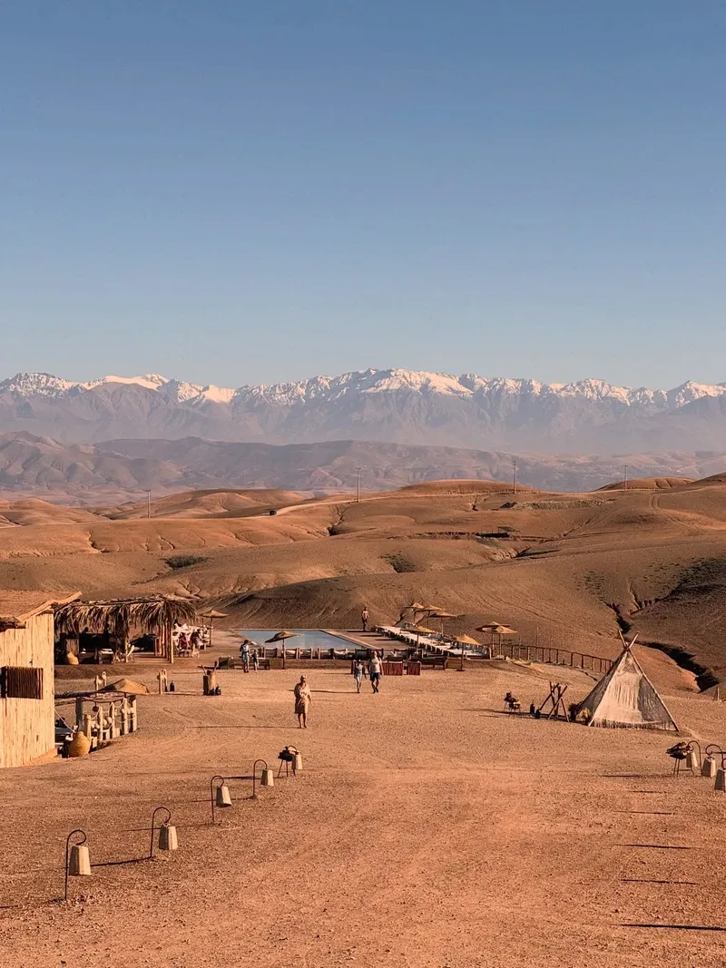
More than 70 private camps operate across the expanse. High-end sites like Terre des Étoiles and Inara Camp pump water into infinity pools that overlook the arid plains. Inara Camp also provides step-free access and adapted restrooms, making the rocky terrain navigable for wheelchair users. Heavy rains in the nearby High Atlas Mountains occasionally send flash floods tearing through the low-lying wadis. Drivers must avoid parking in these dry channels, especially during the volatile winter storm season. Always check the weather forecast for the mountain region, as storms miles away can flood the desert floor hours later.
Just 15 minutes west of the desert edge lies Lalla Takerkoust Lake, a massive man-made reservoir. The blue water provides a stark contrast to the arid stone, offering jet skiing and boat rentals. An hour further south, the Ourika Valley introduces lush greenery and waterfalls, showcasing the extreme ecological diversity of the surrounding Marrakech region.
A prehistoric lake once filled the entire 400-square-kilometer basin between the High Atlas Mountains and the plains of Marrakech. The water evaporated thousands of years ago as the regional climate shifted and global temperatures rose. This evaporation left behind a thick, mineral-rich crust of clay, marl, and volcanic rock. The resulting landscape mirrors the moon, devoid of the massive sand ergs found nine hours south in Merzouga or Zagora. Geological surveys show the sediment layers hold virtually no groundwater near the surface, making early permanent settlement impossible.
Nomadic Berber communities claimed the territory for centuries. Herders utilized the harsh environment during brief windows of opportunity following winter storms. Rainwater briefly transforms sections of the stone desert into sparse grasslands, allowing goats and sheep to graze. These pastoralists built temporary settlements near the wadis, relying on the seasonal water flow to sustain their flocks before moving toward the cooler mountain elevations in summer. They left behind no permanent structures, only faint tracks worn into the stone by centuries of hoof traffic.
Tourism operators recognized the region's logistical value in the early 2010s. Marrakech needed a desert experience that did not require a grueling two-day drive. Developers began leasing tracts of the rocky plateau to build permanent luxury camps. The installation of solar power arrays and deep water wells allowed these sites to offer flush toilets, king-size beds, and heated pools in a completely barren environment. The transition from a nomadic grazing ground to a commercial hospitality zone took less than a decade.
The rapid expansion brought over 70 active camps to the area by the 2020s. Unpaved tracks now branch off the main asphalt roads, connecting isolated tent clusters to the highway. Navigating these final two kilometers requires a 4x4 vehicle or careful driving, as the rutted paths easily trap standard rental cars. Local authorities have implemented stricter zoning laws to manage the environmental impact of off-road vehicles. Drones require a permit from the Moroccan Cinematographic Center, and camp operators will report unauthorized flights to the regional gendarmerie.
Eighty meters of elevation separate the lowest dry riverbeds from the highest rocky ridges in the Agafay basin. The ground consists of tightly packed marl, a crumbly mudstone that shatters under the weight of vehicle tires. Wind erosion prevents sand from accumulating. It sweeps fine particles toward the Atlantic and leaves only heavy volcanic sediments behind. This firm surface allows quad bikes and buggies to reach speeds of 60 kilometers per hour across the open plains. The dust kicked up by these vehicles hangs in the air for hours during windless afternoons.
The Enchanted Oasis breaks the monochrome landscape of white and ochre stone. Seven hectares of eucalyptus and olive trees grow in a deep valley, sustained by a wadi that channels runoff from the High Atlas Mountains. The contrast is sharp. A visitor can stand in completely barren, sun-baked clay and walk fifty paces into dense, shaded greenery. Frogs and small birds inhabit this micro-climate, sustained by the moisture trapped beneath the tree canopy. The oasis marks the primary turning point for the 60-minute sunset camel treks offered by surrounding camps.
Light pollution is nearly non-existent outside the immediate glow of the luxury camps. The 600-meter elevation and low atmospheric moisture create ideal conditions for stargazing. Constellations appear sharply defined against the black sky once the camp generators power down at midnight. Nighttime temperatures drop rapidly without cloud cover to trap the day's heat. Pack a heavy jacket if you plan to sit outside after 20:00, even during the peak summer months.
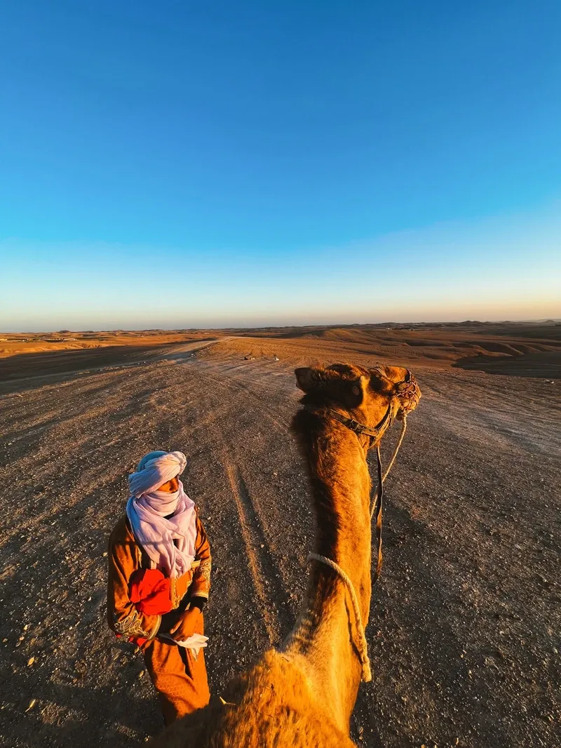
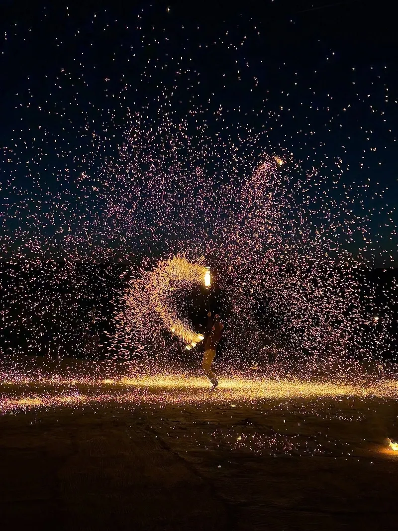
Berber identity shapes the daily operations and aesthetic of the Agafay Desert. Local communities from nearby mountain villages staff the camps, manage the camel herds, and prepare the meals. Dinner services center around the tagine, a conical clay pot that slow-cooks lamb, prunes, and almonds over smoldering charcoal for up to four hours. Musicians play the guembri, a three-stringed bass lute, around the communal fire pits after sunset. The rhythmic drumming and chanting echo across the silent plateau, carrying for miles without trees or buildings to absorb the sound.
The harshness of the 'reg' environment dictates local customs. Modesty remains a practical and cultural requirement. Long, loose garments protect the skin from the relentless sun and blowing dust while respecting the conservative values of the rural workforce. Shoulders and knees must be covered outside of private camp pools. Visitors who arrive in beachwear are often denied entry to the communal dining tents.
Public displays of affection draw negative attention from local residents and staff. Alcohol consumption is strictly confined to the licensed boundaries of private glamping sites, and carrying open containers into the open desert violates local laws. Street touts in Marrakech frequently misrepresent Agafay to tourists, promising towering sand dunes to secure a booking. Verify the exact coordinates of your camp on an offline map before handing over the 350 MAD taxi fare.
Agafay is a 'reg' or stone desert, completely lacking the shifting sand dunes found in the Sahara.
The entire 400-square-kilometer basin was underwater thousands of years ago before climate shifts dried the lake.
A hidden seven-hectare valley of eucalyptus and olive trees thrives in the center of the barren rock.
Winter storms briefly transform the rocky plateau into sparse grasslands used by Berber shepherds.
Flying a drone over the landscape requires explicit permission from the Moroccan Cinematographic Center.
Certain areas of the desert contain military installations where photography is strictly prohibited.
The lack of moisture means temperatures can plummet by 15°C within an hour of the sun setting.
Yes. It is classified as a 'reg' or stone desert. It features an arid climate and barren landscape, but it does not have sand dunes.
No. The ground consists of hard-packed clay, marl, and volcanic rock. Travelers seeking 150-meter sand dunes must drive nine hours south to Merzouga.
The desert begins roughly 35 kilometers south of the city center. The drive takes 45 minutes via paved roads, followed by unpaved tracks to specific camps.
A one-way Grand Taxi from Marrakech costs approximately 350 MAD. You must negotiate and agree on this unmetered fare before getting into the vehicle.
Snakes are extremely rare in this region. The hard, rocky terrain and high volume of human activity around the camps keep most wildlife away from tourist areas.
Standard rental cars can handle the paved highway leading to the desert. However, the final one to two kilometers of dirt tracks are heavily rutted and often require a 4x4 vehicle.
Wear long pants to prevent severe chafing from the coarse camel hair and wooden saddle. Bring a traditional 'cheche' scarf to protect your face from dust and sun.
Most luxury camps provide Wi-Fi in their main dining and reception tents. Standard 4G mobile networks maintain a strong signal across the high plateau.
Summer temperatures regularly exceed 40°C. Visitors should limit their trips to late afternoon sunset dinners or early morning excursions to avoid severe heatstroke.
No. You can hire a private driver or taxi to reach the public areas and individual camps. Tours simply bundle transportation with activities like quad biking and dinner.
Browse verified tours with free cancellation and instant confirmation.
Find Tours